1.13 County supervisory district 13.
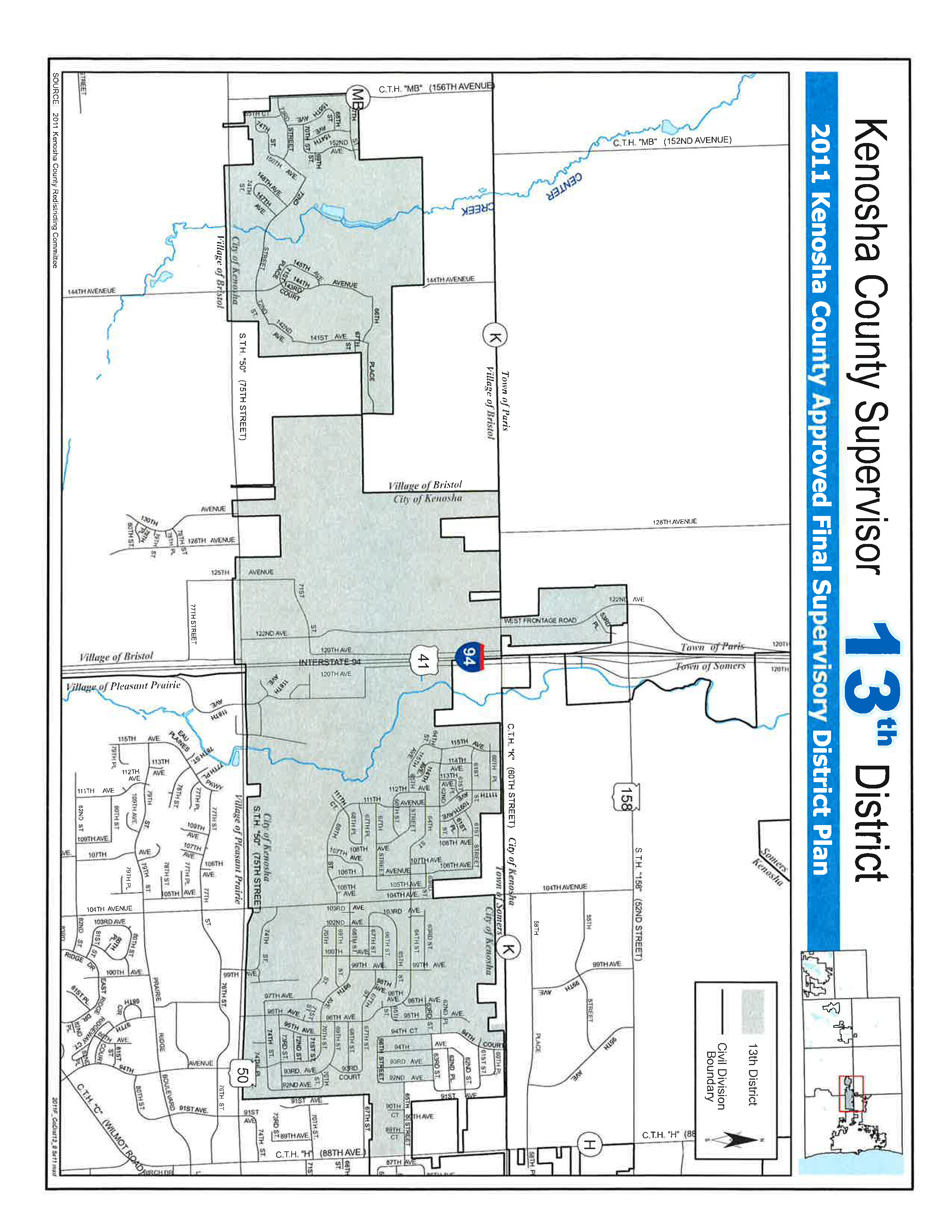
Commence on the centerline of County Trunk Highway “H” said point being the Southeast corner of the Northeast Quarter of Section 5, Township 1 North, Range 22 East of the Fourth Principle Meridian; thence Northerly along the centerline of said road to the intersection with the centerline of 65th Street; thence Westerly along the centerline of said road to the intersection with the centerline of 92nd Avenue; thence North along the centerline of 92nd Avenue to the intersection with the centerline of 63rd Street; thence Westerly along the centerline of 63rd Street to the intersection with the centerline of 94th Court; thence Northerly along the centerline of 94th Court to the intersection with the centerline of 60th Street; thence Westerly along the centerline of 60th Street to a point of intersection with the West line of Outlot 1 Certified Survey Map 2563 said point also being the boundary between the Village of Bristol and the City of Kenosha; thence South along the West line of Outlot 1 Certified Survey Map 2563 to the Southwest corner of said parcel; thence West along the North line of the Southwest Quarter of Section 1, Town 1 North, Range 21 East of the Fourth Principle Meridian being the boundary between the Village of Bristol and the City of Kenosha to the West Quarter corner of said Section said point being the Northwest corner of parcel 03-121-01-301-300; thence Southerly along the West line of said parcel to the Southwest corner of said land; thence East along the said parcel and the boundary between the Village of Bristol and the City of Kenosha 1422.29 feet; thence South along the said parcel and the boundary between municipalities to the centerline of State Trunk Highway “50”; thence Easterly along State Trunk Highway “50” to the intersection with the East line of Whitecaps Unit 1 extended Southerly; thence North along the East line of Whitecaps Unit 1 and Whitecaps Unit 2 to the South line of Peterson’s Golden Meadows South; thence Easterly along the South line of Peterson’s Golden Meadows South and parcel 03-122-05-176-005 and the West and South line of parcel 03-122-05-176-001 to the place of beginning. Excepting therefrom lands administered by the Town of Somers, the Village of Bristol, the Town of Paris and the Village of Pleasant Prairie and lands dedicated for Highway purposes.
Also
Parcels 08-221-36-402-001, 08-221-36-402-002, and 08-221-36-402-003 also including dedicated roads 52nd Street, 83rd Place, and 122nd Avenue (West Frontage Road) bounded by aforementioned parcels.
Also
Certified Survey Map 2501, Strawberry Creek Subdivision, Strawberry Creek Addition 1, Strawberry Creek Addition 2, Strawberry Creek Condominium Addendums 1, 2 and 3, Certified Survey Map 2507, and Heritage Heights Subdivision.
Population of District - 7113 | Percentage of Target 98.3% | % Black 8.04% | % Hispanic 11.78% |