1.21 County supervisory district 21.
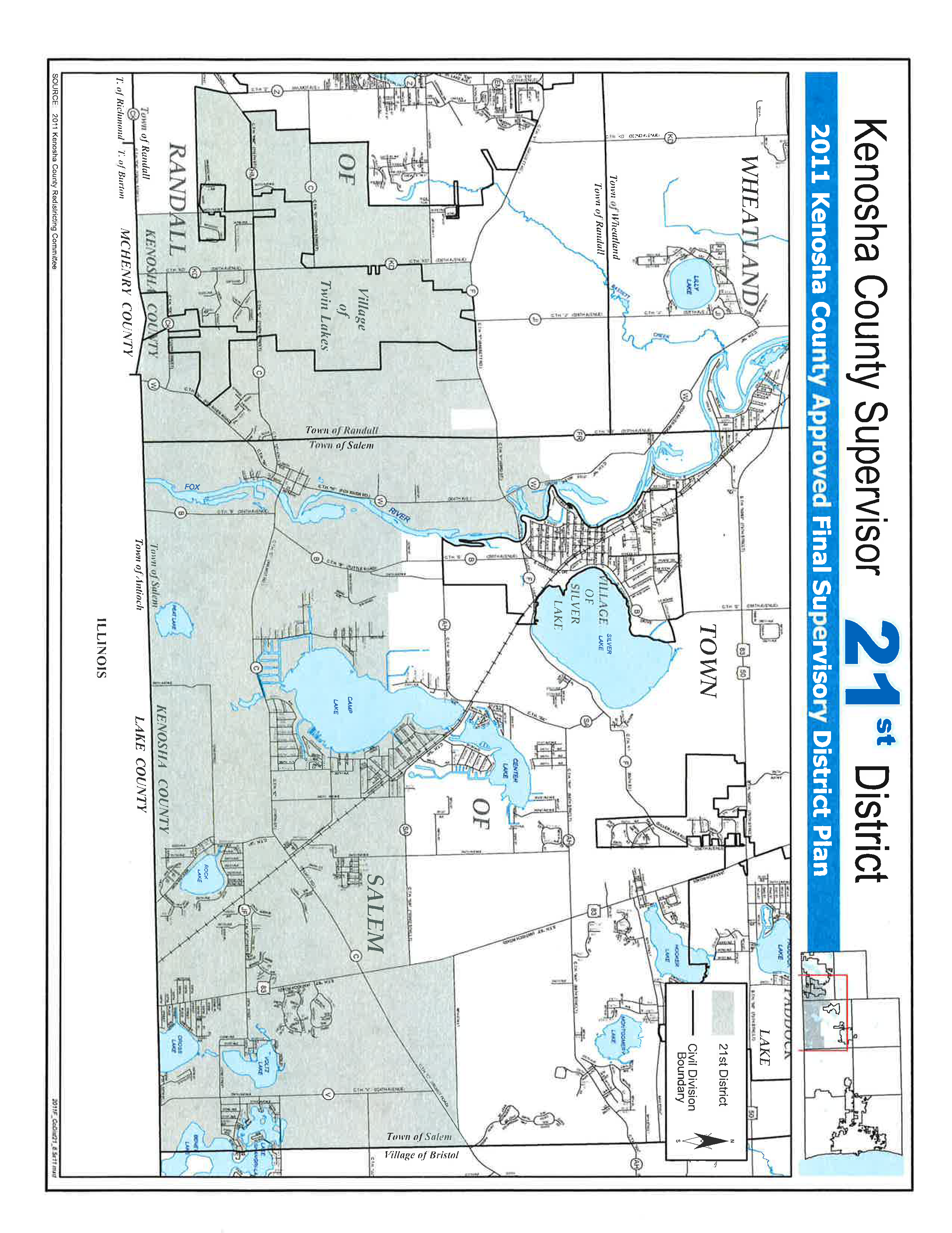
Commence at a point being the Southeastern most corner of Salem Township on the Wisconsin-Illinois border; thence Westerly along said border to the Southwest corner of Salem Township; thence continue Westerly along the Wisconsin-Illinois border being the South line of Randall Township to the intersection with the centerline of 344th Avenue; thence Northerly along the centerline of 344th Avenue to the intersection of said road with the South line of Majestic Estates The Woods Subdivision said point being the boundary line between the Town of Randall and the Village of Twin Lakes; thence Westerly along the South line of said subdivision and the South line of parcel 86-4-119-342-2000 to the Southwest corner of said parcel being the border between the Village of Twin Lakes and the Town of Randall; thence Northerly along the West line of said parcel to the intersection with the centerline of Wilmot Road; thence Northeasterly along said centerline to the intersection with the East line of Lot 2 Certified Survey Map 2192 said point being the border between the Village of Twin Lakes and the Town of Randall; thence Northerly and Easterly along the border between the Village of Twin Lakes and the Town of Randall to a point being the centerline of 98th Street; thence Easterly along the centerline of 98th Street to the intersection with the centerline of 336th Avenue; thence Northerly along the centerline of 336th Avenue to the intersection with the centerline of County Trunk Highway “F” (Bassett Road); thence Northeasterly along said centerline of road to the intersection with the East shoreline of the Fox River being the Westerly limits of the Village of Silver Lake; thence Southerly along the East shoreline of the Fox River to a point being the North line of parcel 65-4-120-194-0301 extended Westerly; thence Easterly along the North line of said parcel to the intersection with the centerline of County Trunk Highway “B”; thence along the centerline of said highway to the intersection with the South line of parcel 65-4-120-203-0520; thence Easterly along the South line of said parcel to the intersection with the centerline of 294th Avenue; thence Southerly along the centerline of 294th Avenue to the intersection with the Southwest corner of Lot 2 Certified Survey Map 1864; thence East along the South line of said Certified Survey Map to the Southeast corner of said land being the intersection with the West line of parcel 65-4-120-203-0200; thence South along said parcel to the Southwest corner of said land said point also being the South line of the Southwest Quarter of Section 21Township 1 North, Range 20 East of the Fourth Principle Meridian; thence Easterly along South line of said Quarter Section to the intersection with the shoreline of Camp Lake; thence Southerly along the Westerly, Southerly, and Easterly shoreline of Camp Lake to a point being the South line of parcel 66-4-120-214-1330 extended; thence Easterly along the South line of said lot as extended to the intersection with the centerline of County Trunk Highway “SA”; thence Southerly and Easterly along the centerline of County Trunk Highway “SA” to the intersection with the centerline of State Trunk Highway “83”; thence Northerly along the centerline of State Trunk Highway “83” to the intersection with the centerline of 98th Street; thence Easterly along the centerline of 98th Street to the East line of Salem Township; thence Southerly along the said East line of Township to the place of beginning. Including parcel 60-4-119-241-0120.
Population of District - 7514 | Percentage of Target 103.84% % Black .92% | % Hispanic 4.68% |